The Honeycombs Wilderness Study Area is located on the east side of Lake Owyhee in Eastern Oregon. It is a rugged area chock full of stunning red and yellow walls of rock. Our destination was to hike the segment of Oregon Desert Trail (ODT) through the Honeycombs, from Leslie Gulch to Lake Owyhee State Park.
So, here we go.
We left the trailhead in Leslie Gulch and headed up Juniper Gulch at lunchtime. It was also Saturday, and the parking lot was full, with 18 vehicles, mostly big pick-up trucks. This was not starting very well. Ten people, twenty people passed us heading down and back to their vehicles.
 |
| The lower part of Juniper Gulch. |
Lunch was taken in the shade of a large reddish-yellow obelisk. A few more day-hikers were walking downhill. There was no water in any of Juniper Gulch, but the view was spectacular.
 |
| The view from the head"waters" of Juniper Gulch |
.
We left the people the minute we left Juniper Gulch. It would be three days before we saw another person. The ODT is a route along most of it's distance and we were starting to experience hiking a route. There had been a trail along much of the Gulch, but beyond was grassland and shrubland, and occasional animal trails.
 |
| Ridge walking. |
Strolling down canyon, into what some have labeled "Let'r Rip Canyon" we saw the remains of pronghorns and bighorn sheep. And lots of leavings from the feral horses.
 |
| The curl of a bighorn sheep. |
 |
| Into an unnamed canyon. |
 |
| Known by others as Let'r Rip Canyon. (Not on any maps). |
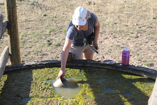
Our first campsite was near a "spring". It may have been suitable for bovines, but left us with a sense of drinking some extra protein. We tried filtering the water, but ended up with a cup of milky water and a clogged filter. So we boiled.
 |
| The spring was somewhat dry. |
 |
| Upstream from camp was a good water source. |
We slept well the first night, although we had hiked a measly twelve kilometers.
 |
| Nighttime near OC171. |
From Craig Canyon we hiked up, over, then down into Painted Canyon. We dropped our backpacks and took a stroll down canyon, and down memory lane. Somewhere down there, on a rocky outcrop of volcanic tuff, I proposed to C, forty years ago. We never relocated the actual place, but we did find a nice pool of refreshing water to fill our bottles.
 |
| Painted Canyon. |
 |
| Fresh, clear, cool, water. |
 |
| Walking past classic honeycombs formation. |
Hard to get lost when you can only go a certain direction; up canyon or down canyon. But sometimes the sagebrush was tall enough to hide even a tall backpacker.
 |
| The big valley. Soon to be a major motion picture. |
 |
| The walls of Painted Canyon. |
 |
| Negotiating a pour-off. |
A short break had me wondering about the distribution of the flavours of Skittles. I'd already consumed the orange and purple, but they were both under two from this fun-sized bag.
 |
| What's the most common Skittle? Let me graph that. |
Twenty-one kilometers of hiking and we were too lazy to put up the tent. Actually, we wanted to do a little star watching, as the moon was close to new, and the sky would be dark.
 |
| Cowboy camping on night two. |
We continued our northward journey on day three. The craggy canyons of the first two days were replaced with vast rolling grasslands. The federal agency managing the public lands had actively altered the landscape years ago by eliminating much of the shrub component. They did this with the intention of increasing forage for domestic livestock. It made for easy hiking.
 |
| Sunshine. |
 |
| Three Fingers from a distance. |
 |
| Montana does not have exclusive use of the phrase big sky. |
There were a couple places with water, a spring and two reservoirs which may dry up in the summer. But as we're walking along, from a distance, we see what look like two blue plastic barrels. Litter, we assume. As we get closer we recognize it as two groups of water jugs, full. Were they just placed there? All ten jugs were sealed and unopened. We left them for the summertime hikers who would need them more than us.
 |
| Another excellent spring. |
 |
| Free water, you pack. |
Past Calhoun Reservoir (very dry) and down into Birch Creek, eighteen kilometers later we were finished with this segment of the Oregon Desert Trail.
 |
| Strolling to the finish at Lake Owyhee State Park. |
Most guides of the ODT indicate it starts in the Badlands Wilderness to the east of Bend, Oregon and finishes 700 miles later at Lake Owyhee State Park. That would be a Central Oregon centric way of looking at the trail. Another perspective would be the start of the trail begins at Lake Owyhee and ends in the Badlands. The Eastern Oregon perspective. Either way, in either direction, the trail is a truly astounding experience for those seeking solitude and vast landscapes.


